Climate Change Impact on India and World – International Reports, Key Observations, etc.

Himachal witnesses gradual snowfall pattern shift  

Note4Students

From UPSC perspective, the following things are important :

Prelims level: Shift in snowfall patterns in Himachal, Rivers and glaciers located

Why in the News?

  • Himachal Pradesh is experiencing a reducing snow cover over the years.
    • There is a noticeable shift in snowfall occurrence from winter months towards early summer months.

Findings from the Latest Study:

  • The study by the Centre on Climate Change of Himachal Pradesh Council for Science Technology-Environment (HIMCOSTE) shows an overall decrease of 12.72% in snow cover area in 2023-24 compared to 2022-23.
  • The study used Advanced Wide Field Sensor (AWiFS) satellite data to analyze snow cover trends.
  • Early winter months (October-November) showed a decrease in snow cover area except for the Ravi basin, which showed a marginal increase in October.
  • Peak winter months (December-January) saw a negative trend in snow cover area.
  • Late winter months (February-March) showed a positive trend with an increase in snow cover area in all basins compared to the previous year.
  • Snow cover area increased in April due to fresh snowfall in the early summer period.

Impact on Water Availability

  • The decrease in snow cover during peak winter months (December and January) is especially alarming.
  • Snowfall during these months sustains longer and enhances the discharge dependability of major river basins during summer.
  • Reduced snow cover in winter could affect water availability during the summer months.

Concerns and Implications

  • Environmentalists and scientists are concerned about the shifting snowfall patterns.
  • Depleting snow cover and changing snowfall patterns have significant impacts on hydro-power, water sources, people, livestock, forests, farms, and infrastructure.

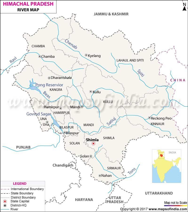
Back2Basics: Rivers of Himachal Pradesh   

Description
Satluj
  • Originating from Rakas Lake in Tibet, the Satluj River is the longest river in Himachal Pradesh.
  • It flows through the districts of Kinnaur, Shimla, Kullu, Mandi, Solan, and Bilaspur, and enters Punjab near Nangal.
  • The river is crucial for hydropower generation and irrigation.
  • Hydropower Dams: Bhakra Dam (Bhakra-Nangal Project), Nathpa Jhakri Dam, Karcham Wangtoo Dam.
  • Glaciers Feeding: Rakas Lake (Tibet), Zema Glacier, Shipki La Glacier.
Beas
  • The Beas River originates from Beas Kund near Rohtang Pass.
  • It flows through the districts of Kullu, Mandi, Hamirpur, and Kangra, eventually entering Punjab.
  • It is known for its picturesque valleys and is significant for agriculture and hydropower.
  • Hydropower Dams: Pandoh Dam, Pong Dam (Maharana Pratap Sagar).
  • Glaciers Feeding: Beas Kund Glacier.
Ravi
  • Originating from the Bara Bhangal Glacier in the Himalayas, the Ravi River flows through the Chamba district of Himachal Pradesh.
  • It eventually enters Pakistan. The river is crucial for both hydropower and irrigation in the region.
  • Hydropower Dams: Chamera Dam (Chamera I, II, and III).
  • Glaciers Feeding: Bara Bhangal Glacier.
Chenab
  • The Chenab River, formed by the confluence of the Chandra and Bhaga rivers, originates from the Bara Lacha Pass in Lahaul-Spiti.
  • It flows through the districts of Lahaul and Chamba before entering Jammu and Kashmir.
  • It is one of the largest rivers in terms of discharge and is vital for hydropower.
  • Hydropower Dams: No major dams within Himachal Pradesh, but significant potential for hydropower.
  • Glaciers Feeding: Bara Shigri Glacier, Miyar Glacier.
Yamuna
  • The Yamuna River originates from the Yamunotri Glacier in the Garhwal Himalayas.
  • It forms the eastern boundary of Himachal Pradesh with Uttarakhand.
  • It is one of the most sacred rivers in India and supports major irrigation systems downstream.
  • Hydropower Dams: No significant major hydropower projects within Himachal Pradesh (major dams located downstream in Uttarakhand and Uttar Pradesh).
  • Glaciers Feeding: Yamunotri Glacier.
Spiti
  • The Spiti River originates from the Kunzum Range and flows through the cold desert region of Spiti Valley in Himachal Pradesh.
  • It joins the Satluj River near Khab. The river is known for its stunning landscapes and unique ecosystem.
  • Hydropower Dams: No significant major hydropower projects (projects primarily focused on other rivers in the region).
  • Glaciers Feeding: Kunzum Range Glaciers.
Parbati
  • The Parbati River originates from the Parbati Glacier in the Kullu district.
  • It is a tributary of the Beas River.
  • The river is significant for its hydropower potential and scenic beauty, attracting many trekkers and nature enthusiasts.
  • Hydropower Dams: Parbati Hydroelectric Project.
  • Glaciers Feeding: Parbati Glacier.

Get an IAS/IPS ranker as your 1: 1 personal mentor for UPSC 2024

Attend Now

Subscribe
Notify of
0 Comments
Inline Feedbacks
View all comments

JOIN THE COMMUNITY

Join us across Social Media platforms.

💥Mentorship New Batch Launch