Drainage
The flow of water through well-defined channels is known as ‘drainage’ and the network of such channels is called a ‘drainage system’.
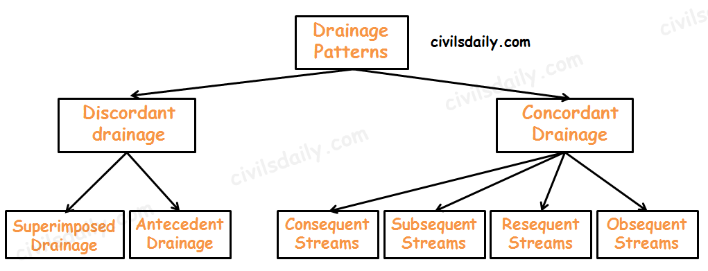
Discordant drainage
A pattern of drainage that bears no relation to the structure of the underlying rock. This may be because:
- The drainage pattern developed on rock strata that have since been removed by erosion; a process known as superimposition. The drainage pattern thus developed is called superimposed drainage (or Epigenetic or Superinduced Drainage). Examples: The Damodar, the Subarnarekha, the Chambal, the Banas and the rivers flowing at the Rewa Plateau, rivers of eastern USA and southern France.
- The drainage pattern was already present before a period of uplift and folding that formed the present structure. As the uplift took place, the rivers were able to cut down at approximately the same rate and so maintain their courses. This process is called antecedence and the drainage system thus developed is called antecedent drainage.
Many of the Himalayan rivers have antecedent origin i.e. these rivers existed even before the Himalayan ranges were uplifted. These rivers originate in the Tibetan side beyond the mountain ranges of Himalayas. The Indus, Satluj, Alaknanda, Gandak, Kosi, Brahmaputra all have an antecedent origin. Since these rivers are antecedent, they run transverse to the mountain ranges cutting deep V-shaped, steep-sided valleys (deep gorges).
Concordant Drainage (also called accordant drainage)
The pattern of drainage which arises from and closely follows the trends of the underlying strata is called concordant drainage.
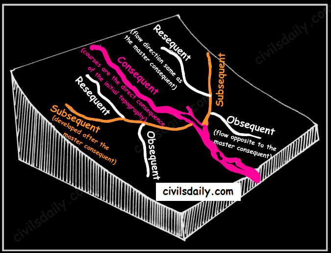
- Consequent Streams: Those streams whose courses are the direct consequence of the initial topography are called consequent streams.
- Subsequent Streams: These are developed after the master consequent.
- Obsequent streams: These flow in opposite direction to the master consequent.
- Resequent Streams: A resequent stream flows in the same direction as that of the initial consequent stream, but which develops in response to a new base level formed due to inversion of relief.
Drainage pattern:
Drainage pattern refers to a design which a river and its tributaries form together from its source to its mouth. The drainage pattern of an area is the outcome of:
- The geological time period,
- Nature and structure of rocks,
- Topography,
- Slope,
- Amount of water flowing, and
- The periodicity of the flow.
Some Important Drainage Patterns:
A combination of several patterns may be found in the same drainage basin.
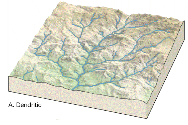
- Dendritic: The dendritic pattern develops where the river channel follows the slope of the terrain. The drainage pattern resembling the branches of a tree is known as “dendritic” the examples of which are the rivers of northern plain. It is the most common stream pattern. A dendritic pattern develops in a terrain which has uniform lithology, and where faulting and jointing are insignificant.
Source
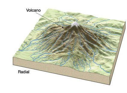
- Radial: The radial pattern develops when streams flow in different directions from a central peak or a dome-like structure. E.g. the rivers like the Narmada, Son and Mahanadi originating from Maikal Hills flow in different directions and are good examples of a radial pattern.
Radial drainage patterns are also found/in the Girnar Hills (Kathiwar, Gujarat), and Mikir Hills of Assam.
Source
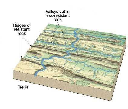
- Trellis: When the primary tributaries of rivers flow parallel to each other and secondary tributaries join them at right angles, the pattern is known as ‘trellis’. A trellis drainage pattern develops where hard and soft rocks lie parallel to each other. For example, rivers in the upper part of the Himalayan region and in the old folded mountains of the Singhbhum (Chotanagpur Plateau) have drainage of trellis pattern. The trellis drainage pattern can also be seen in the Appalachian region of the U.S.A., where hard and soft rocks occur in parallel bands.
Source
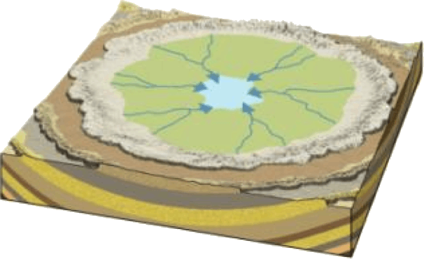
- Centripetal: When the rivers discharge their waters from all directions in a lake or depression, the pattern is known as ‘centripetal’. This drainage pattern is also called endorheic drainage. For example, Loktak lake in Manipur.
Source
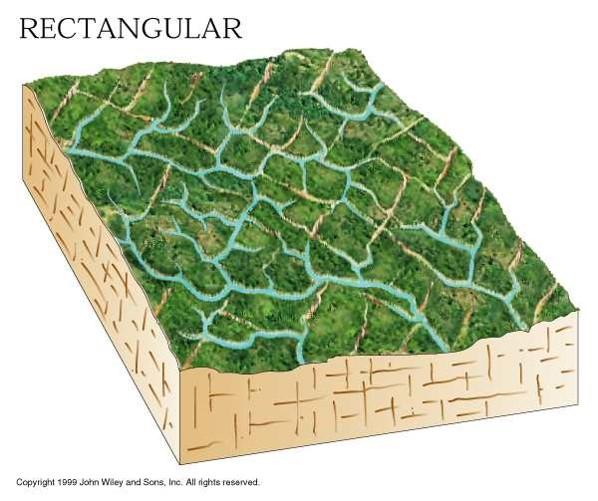
- Rectangular: In this drainage, both the main stream and its tributaries show right-angled bends. A rectangular drainage pattern develops on a strongly jointed rocky terrain. It differs from trellis pattern drainage, since it is more irregular and its tributary streams are not as long or as parallel as in trellis drainage. Example: Colorado river (USA), streams found is the Vindhyan Mountains of India.
Source
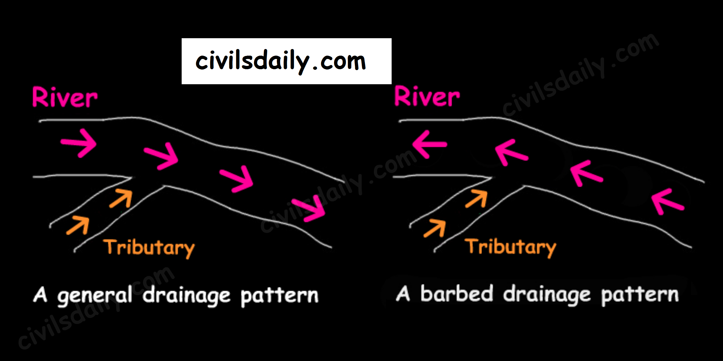
- Barbed: If you look at the way that tributaries empty into larger rivers, you will notice that most of them flow in the same direction as the rivers they empty into. But quite a large number flow the other way. In fact, you will find stretches of some rivers where every tributary empties into the river in the “wrong” direction! Such an occurrence is known as a barbed drainage pattern.
Most barbed drainage patterns are the result of river-capture which reverses the direction of flow. However, the tributary channels continue to flow in their original direction.
The Arun River (Nepal), a tributary of the Kosi is an interesting example of barbed drainage pattern.
- Annular: Annular pattern represents that part of a drainage pattern in which the subsequent streams follow the curving or arcuate courses before joining the consequent stream. These results from a partial adaptation to an underground circular structure i.e. batholiths. This is not a very common drainage pattern in India. Some examples of this are however found in Pithoragarh (Uttarakhand), Nilgiri Hills in Tamil Nadu and Kerala.
Source
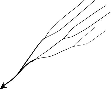
- Parallel drainage: The drainage pattern in which the rivers flow almost parallel to each other is known as parallel drainage. The small and swift rivers originating in the Western Ghats and discharging their water into the Arabian Sea provide a good example of parallel drainage pattern in India.
Source
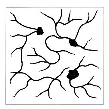
- Deranged pattern: This is an uncoordinated pattern of drainage characteristic of a region recently vacated by an ice-sheet. The picture is one of numerous water courses, lakes and marshes; some inter-connected and some in local drainage basins of their own. This type of drainage is found in the glaciated valleys of Karakoram.
