Note4Students
From UPSC perspective, the following things are important :
Prelims level: Seamounts
Mains level: NA

Central Idea: Scientists have reported finding 19,325 new seamounts after poring through new high-resolution data. A study had already mapped 24,000 seamounts across the world’s oceans.
Why study this?
- The recent discovery of new seamounts was made possible by advancements in altimetry for gravity-field mapping, which improved spatial coverage.
- The CryoSat-2, Envisat, Jason-1 geodetic missions, and the SARAL satellite developed by India and France contributed to these advancements.
What are Seamounts?
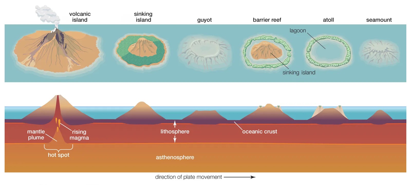
- Seamounts are underwater mountains formed through volcanic activity.
- They are recognised as hotspots for marine life.
- Most seamounts are formed near mid-ocean ridges, intraplate hotspots, and oceanic island chains with volcanic and seismic activity called island arcs.
- They can be active, extinct or dormant volcanoes.
Importance of Seamounts
- Seamounts provide information about the mantle’s composition and how tectonic plates evolve as they are formed when molten rock comes up from below the tectonic plates.
- Oceanographers study seamounts to understand their influence on how water circulates and absorbs heat and carbon dioxide.
- Seamounts are home to diverse biological communities as they can cause localised ocean upwelling, which brings nutrient-rich water from deep within the ocean to the surface.
How were they mapped?
- Surveyors map seamounts using either echo sounders or multibeam sonar on ships for topographic mapping or using satellite altimetry for gravity-field mapping.
- The hi-res maps produced by multibeam sonar mapping are often incomplete, whereas the low-res maps produced by satellite altimetry have better coverage.
Get an IAS/IPS ranker as your 1: 1 personal mentor for UPSC 2024

