Article Outline:
- Location and Extent
- Geological History and Features
- Chief Characteristics
- General elevation and flow of rivers
- Important physiographic features
- The Deccan Trap
- Physiographic Divisions
- The Central Highlands
- The Deccan Plateau
- The Northeastern Plateau.
- Hill ranges of the peninsula
- The Aravallis
- Vindhyan Ranges
- Satpura ranges
- Western and Eastern Ghats
- Significance of this region
Peninsular Plateau is the oldest and largest Physiographic unit of India.
A. Location and Extent
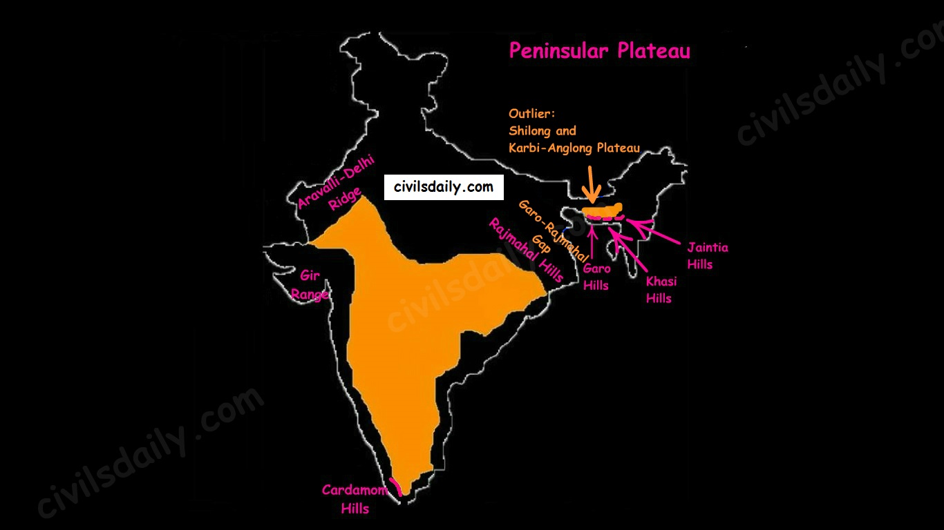
- The Peninsular Plateau lies to the south of the Northern Plains of the India.
- It is bordered on all sides by the hill ranges:
- Delhi ridge in the north-west (extension of Aravalis),
- the Rajmahal hills in the east,
- Gir range in the west, and
- the Cardamom hills in the south constitute the outer extent of the peninsular plateau.

- Outlier:
- Shillong and Karbi-Anglong plateau.
Note: Kutchch Kathiawar region – The region, though an extension of Peninsular plateau (because Kathiawar is made of the Deccan Lava and there are tertiary rocks in the Kutch area), they are now treated as integral part of the Western Coastal Plains as they are now levelled down.
- The Garo-Rajmahal Gap:
- The two disconnected outlying segments of the plateau region are seen in the Rajmahal and Garo-Khasi Jaintia hills.
- It is believed that due to the force exerted by the northeastward movement of the Indian plate at the time of the Himalayan origin, a huge fault was created between the Rajmahal hills and the Meghalaya plateau
- Later, this depression got filled up by the deposition activity of the numerous rivers.
- As a result, today the Meghalaya and Karbi Anglong plateau stand detached from the main Peninsular Block.
Geological History and Features:
The peninsular plateau is a tableland which contains igneous and metamorphic rocks. It is one of the oldest and the most stable landmass of India.
In its otherwise stable history, the peninsula has seen a few changes like:
- Gondwana Coal Formation.
- Narmada-Tapi rift valley formation.
- Basalt Lava eruption on Deccan plateau:
During its journey northward after breaking off from the rest of Gondwana, the Indian Plate passed over a geologic hotspot, the Réunion hotspot, which caused extensive melting underneath the Indian Craton. The melting broke through the surface of the craton in a massive flood basalt event, creating what is known as the Deccan Traps (Its various features have been discussed in the later portion of the article).
Chief Characteristics:
The entire peninsular plateau region is an aggregation of several smaller plateaus and hill ranges interspersed with river basins and valleys. The Chhattisgarh plain occupied by the dense Dandakaranya forests is the only plain in the peninsula.
1. General elevation and flow of rivers:
- The average elevation is 600-900 metres.
- The general elevation of the plateau is from the west to the east, which is also proved by the pattern of the flow of rivers.
- Barring Narmada and Tapti all the major rivers lying to the south of the Vindhyas flow eastwards to fall into the Bay of Bengal.
- The westward flow of Narmada and Tapi is assigned to the fact that they have been flowing through faults or rifts which were probably caused when the Himalayas began to emerge from the Tethys Sea of the olden times.
2. Some of the important physiographic features of this region are:
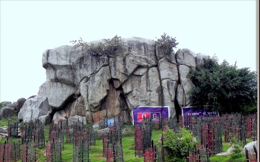
- Tors – Prominent, isolated mass of jointed, weathered rock, usually granite.
A granite tor near Ranchi
- Block Mountains and Rift Valleys:
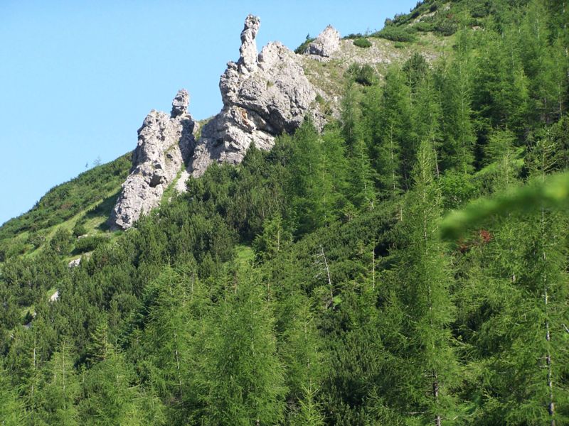
- Spurs: A marked projection of land from a mountain or a ridge
Image Source
- Bare rocky structures,
- Series of hummocky hills and wall-like quartzite dykes offering natural sites for water storage.
- Broad and shallow valleys and rounded hills
- Ravines and gorges: The northwestern part of the plateau has a complex relief of ravines and gorges. The ravines of Chambal, Bhind and Morena are some of the well-known examples.
3. The Deccan Traps:
- One of the most important features of the peninsular plateau is the black soil area in the western and northwestern part of the plateau, which is known as the Deccan Trap.
- From the end of the Cretacious until the beginning of the Eocene, numerous fissure-type eruptions took place in the north-western part of the Deccan plateau. It is believed that the lava outpourings were more than the mass comprising the present-day Himalayas.
- It covers a major portion of the Maharashtra plateau and parts of Gujarat, northern Karnataka and Malwa plateau. Some parts of Tamil Nadu, Andhra Pradesh, UP, and Jharkhand have some outliers of Deccan trap.
- Basalt is the main rock of the region.
- The region has black cotton soil as a result of weathering of this lava material and this soil is one of the finest examples of the parent material controlled soils.


very nice info , thanks