Why in the News?
- Tuti Island has drawn attention as residents return after a prolonged siege during the Sudan conflict 2023.
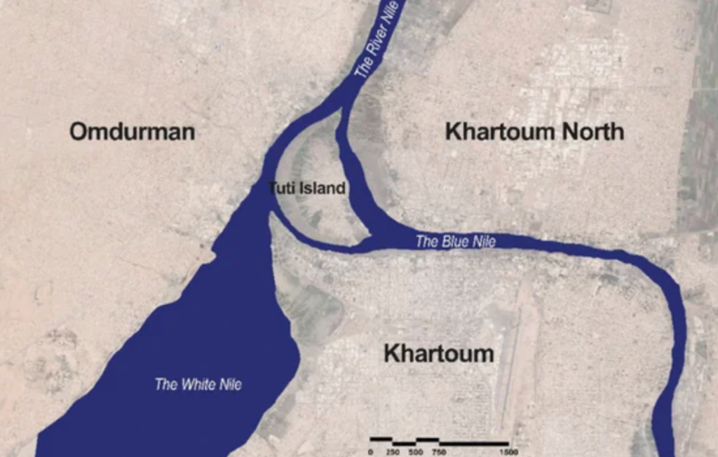
Location & Geography
- Located in Khartoum
- Lies at the confluence of:
- White Nile (from Uganda region)
- Blue Nile (from Ethiopia)
- Forms the River Nile, flowing north to Egypt
Key Features
- Crescent-shaped river island
- Historically: Agricultural hub supplying fresh produce to Khartoum
- Old settlement: Mosque dating back to 1480
Sudan Conflict Context
- War between: Sudanese Army and Rapid Support Forces
Timeline
- Conflict began: April 2023
- Tuti Island siege: June 2023 to March 2025
| [2024] Consider the following pairs: Country: Reason for being in the news 1. Argentina: Worst economic crisis 2. Sudan : War between the country’s regular army and paramilitary forces 3. Turkey : Rescinded its membership of NATO How many of the pairs given above are correctly matched? [A] Only one pair [B] Only two pairs [C] All three pairs [D] None of the pairs |